A History of the People and the Places around the River Borora in County Meath, Ireland
Moynalty Civil Parish
Ballymakane
1. Ringfort (26 x 23.8m). Raised subcircular area with low earthen bank and traces of an external fosse. Original entrance probably at east.
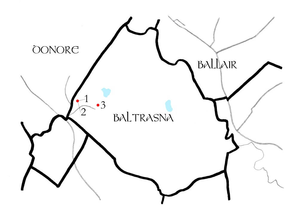
Baltrasna
1. Enclosure (Diameter 58 x 35m). Described as ‘Baltrasna Fort’ on the 1836 and 1912 OS 6″ maps. There is no visible fosse or entrance and only a scarp remains, along with the remains of a house of unknown date.
2. House (3.6 x 3.3m). The foundations of a house remain with a wall footing visible to the west.
3. Enclosure (Diameter c 40m).Raised platform with a stone faced scarp. Marked as ‘fort’ on the 1836 OS 6″ map.
Billywood
1. Ringfort (29.5 x 27m). Remains of an earthen bank and external fosse. Original entrance at ENE.
2. Ringfort (26.8 x 24m). Raised circular area with a scarp and external fosse. Possible entrance at SE.
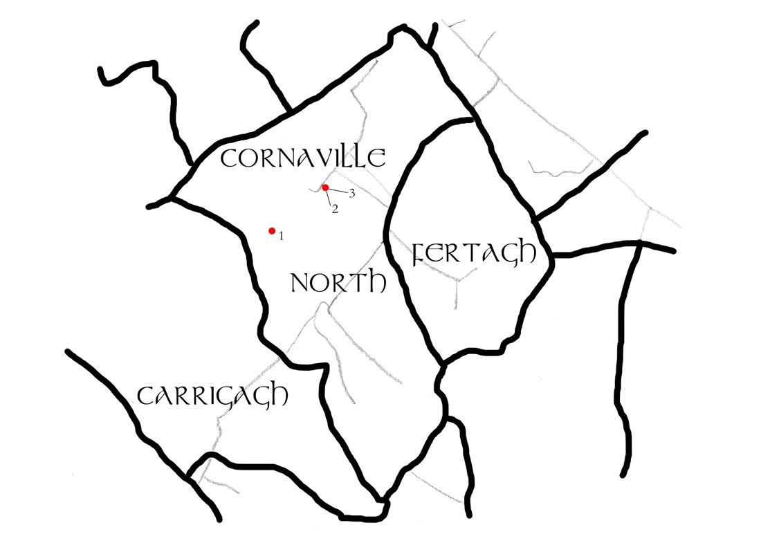
Cornaville North
1. Court Tomb (6.3 x 2.3m). Three chambered court tomb located at NW of a cairn (40 x 15m) which is aligned NW-SE.
2. Ringfort (30 x 15.5m). Recorded as a D-shaped area in 1969 but is no longer visible. A scarp remains with a hut site to the SE. There is an entrance ramp at ESE.
3. Hut Site (Diameter 6m). A hut, defined by a small bank, was located in the SE section of the Rath but is no longer visible.
Carrickspringan
1. Ringfort (Diameter 23.3m). Wide earthen bank with external flat bottomed fosse. Ramp entrance and causeway at ENE.
2. House Site (4.7 x 2.1m). Rectangular area inside fort, denoted by slight earthen banks.
3. House Site (5.5 x 2.2m). Rectangular area inside fort, denoted by low earthen banks and a doorway.
4. Promontory Fort – inland (c.50 x 50 x 50m). Triangular area located on a rock outcrop with the remains of two house sites within. A stone and earthen bank protects the site to the north while there is a steep slope to the south.
5. House Site (4.35 x 2.5m). Rectangular area situated outside the bank of the fort to the NE. There is a path leading down the slope from here.
6. HouseSite (7.1 x 3.6m). Earthen banks mark the location of a house which was located at the bottom of the slope leading up to the promontory fort.
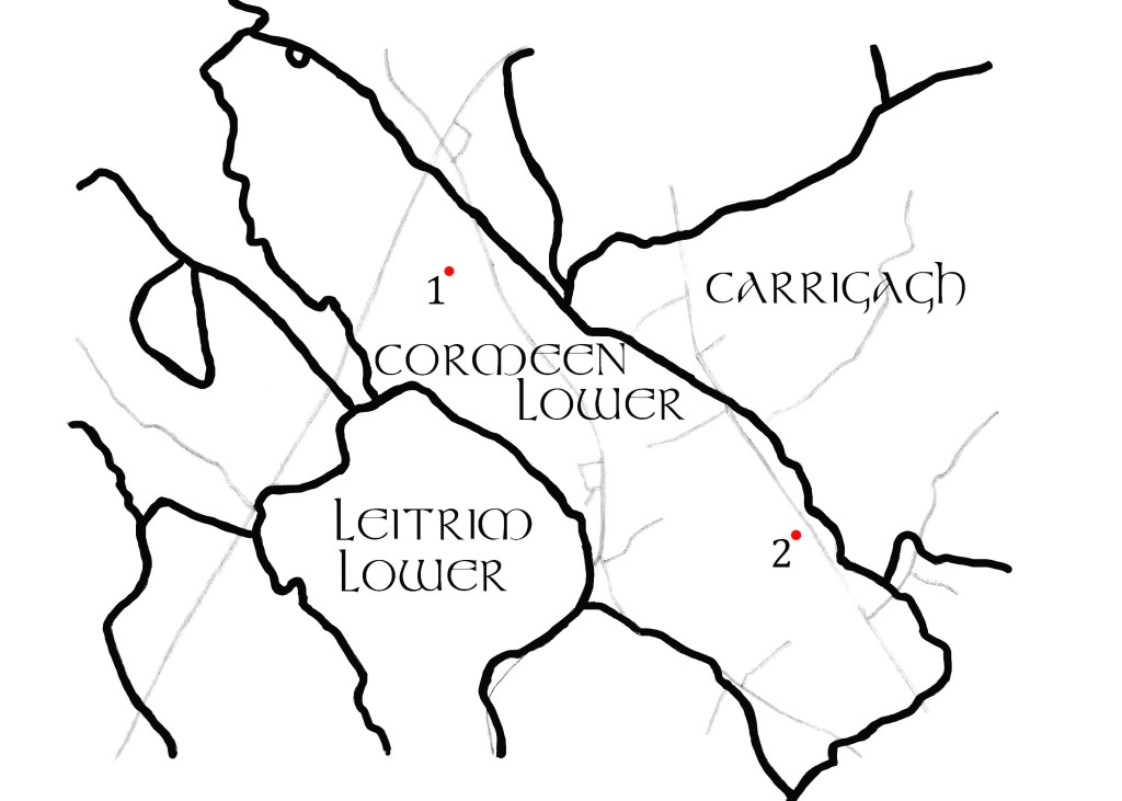
Cormeen Lower
1. Ringfort (Diameter c. 30m). Located on a slight drumlin ridge. A circular embanked enclosure marked as ‘fort’ on the 1836 edition of the OS 6″ map.
2. Ringfort (42 x 39m). Located near the top of a drumlin ridge. Earthen bank with traces of an external fosse. Described as ‘Cormeen Fort’ on the OS 6″ maps.
Carrigagh
1. Ringfort (39 x 31m). Situated near the top of a drumlin ridge. Oval area with a scarp but no visible fosse or entrance.
Diralagh
1. Ringfort. Located at the bottom of a drumlin ridge. Marked as a fort on the 1805 manuscript map in the National Library of Ireland but no visible trace remains.
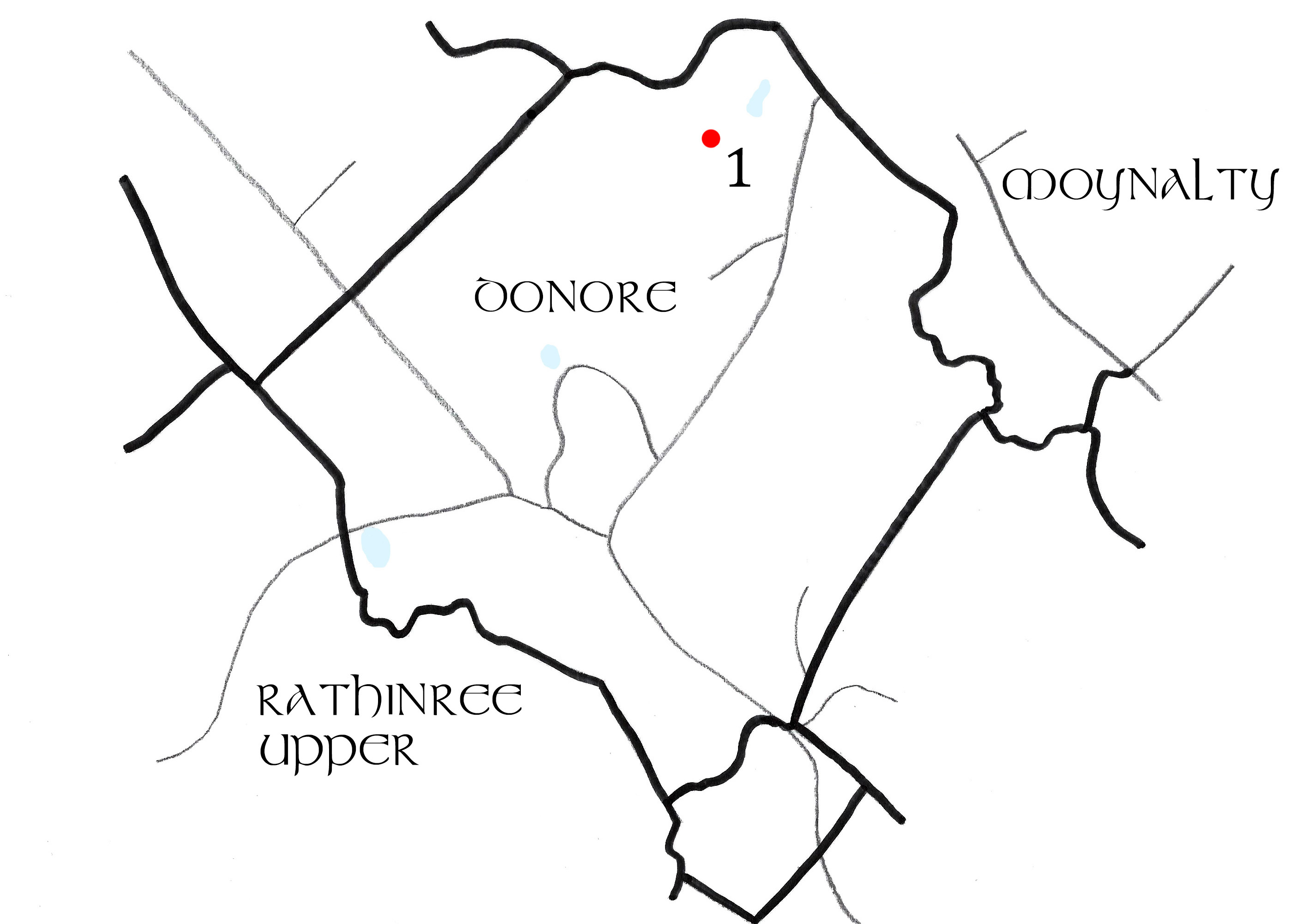
Donore
1. Mound (Diameter of top c.10m). Flat-topped mound with the remains of an outer bank to the south. The ‘Donore Hoard’, a collection of fine 8th century metalwork including an ornate door handle, was found 250m to the north of here.
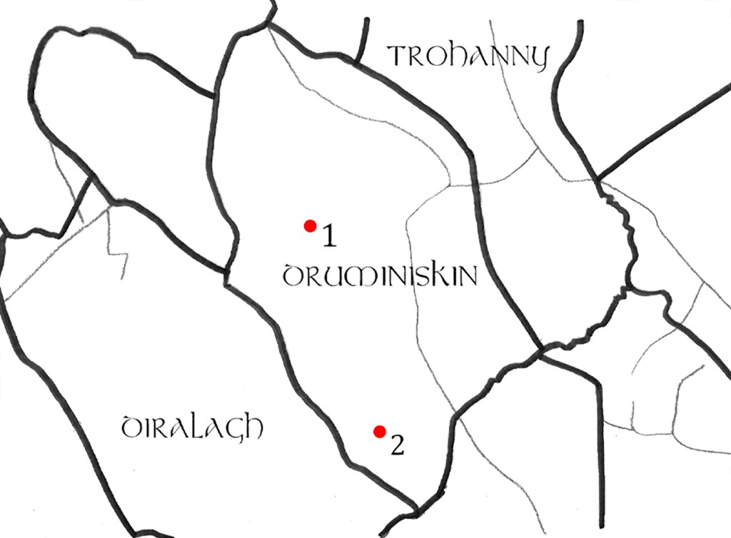
Druminiskin
1. Ringfort (38 x 33m). Described as ‘The Black Fort’ on the OS 6″ maps. Earthen bank with external fosse, middle bank with external fosse, and traces of a third outer bank also with an external fosse.
2. Ringfort (25.5 x 24.5m). The earthen bank has been reduced to a scarp but there are traces of an external fosse.
Farranadoony
1. Ringfort (Diameter 25m). In 1969 a raised circular area was recorded and had the remains of a scarp and traces of an external fosse. There was a ramp entrance at NE.
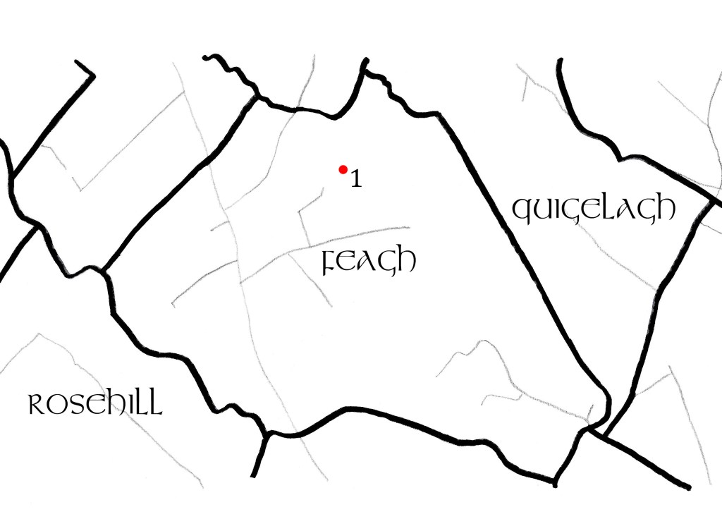
Feagh
1. Ringfort (30 x 20m). On the 1836 OS 6″ map a D-shaped enclosure appeared here, but featured on the 1908 map as a tear-shaped enclosure. There is only part of a bank remaining at the SE.
Golashane
1. Holy Well. No information available at present (Aug. 2024)
2. Ringfort (59 x 48m). Earthen bank with external fosse. Possible ramp entrance at SE.
Moynalty
1. Motte (Diameter c. 16m at top, c. 36m at bottom). Flat-topped mound between 4.3 and 6m high overlooking the Borora River. There is a possible Bailey to the SE measuring c. 39 x c. 31m.
2. Ringfort (Diameter 40m). Earthen bank and external fosse, described as ‘Reillystown Fort’ on the 1836and 1912 OS 6″ maps.
3. Church. There are taxation records of a church existing in Moynalty from the early 1300’s which by the mid 1600’s lay in ruins. Its location is probably that of St. Mary’s Church of Ireland which was built in 1819.
4. Mill (Internal dimensions 1.75 x 1.7m). The corner of a stone structure was found beside the river. It is likely one of two water mills that lay in ruin at the time of the Civil Survey (1655-6).
5. Kiln (L. 4m, W. 1.6m, D. 0.7m). A ‘keyhole’ corn drying kiln was excavated here and a bowl with charred cereal found.
6. Burnt Mound. Four areas of burnt stone were excavated here and were likely associated with the nearby prehistoric site.
7. Prehistoric Site. Two pits, a gully, a flint blade and two pieces of prehistoric pottery were found here. A large settlement likely existed in this area.
Newcastle
1. Castle: Tower House (Remaining wall L. 7m, H. 2m, T. 1.5m). Only one wall with a part of a curving tower to the north remains of this castle. It is incorporated into the wall of a farm building, which was probably originally part of a Bawn.
Quigelagh
1. Crannog (37 x 20m). Now located on dry land, there is an oval mound situated here in a low-lying basin between drumlins. This is probably the site referred to as Móin na Locha in local folklore.
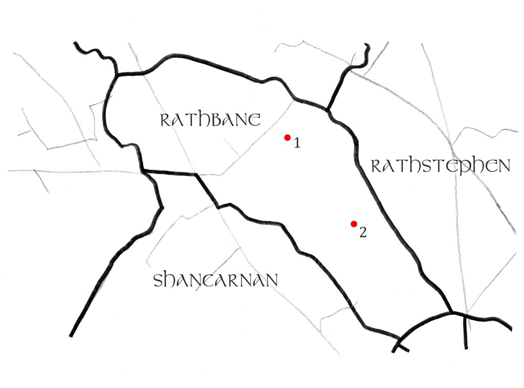
Rathbane
1. Ringfort (Diameter 29m). Raised circular area with earthen bank, external fosse and secondary outer bank. Causeway and entrance through outer bank at east.
2. Souterrain (Diameter 13ft, Height 7.5ft). A large circular souterrain was found here in 1920. It was accessed through a passageway (H. 3.5ft, W. 2.5ft) at least 25 feet long.
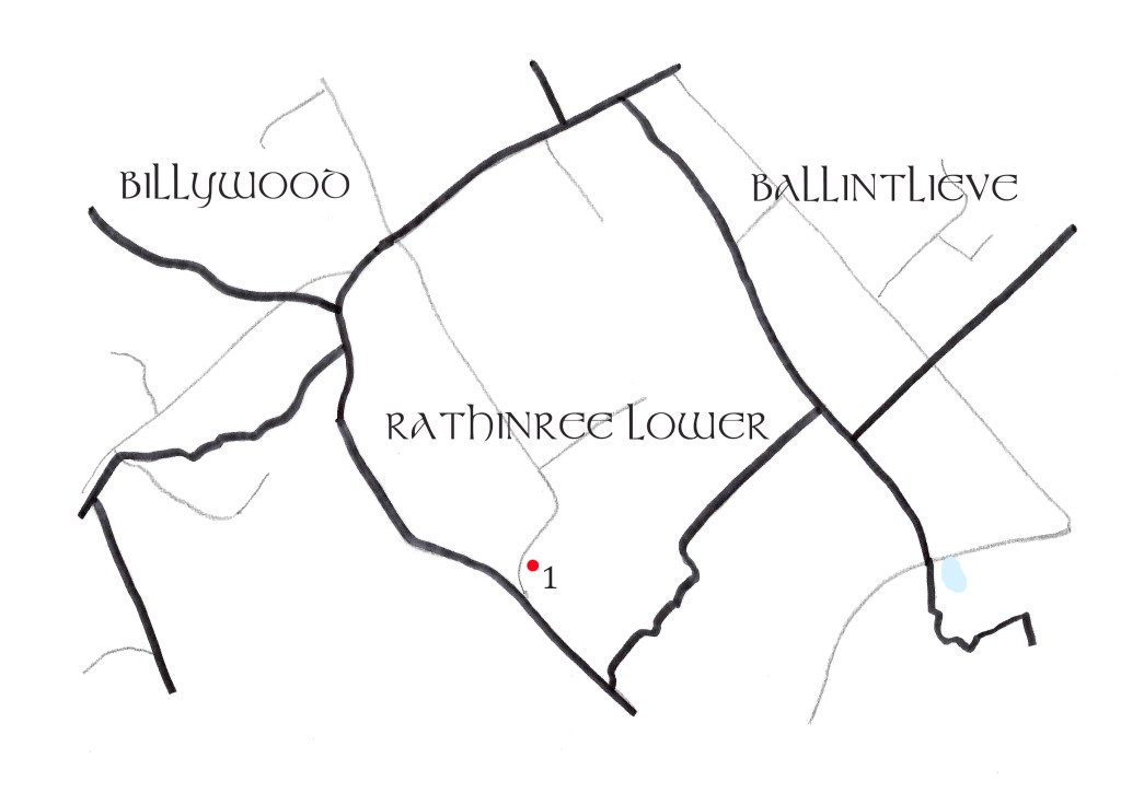
Rathinree Lower
1. Earthwork (Diameter c.70m). Appeared as a large enclosure on the 1836 OS 6″ map but there are currently no visible remains.
Rathinree Upper
1. Enclosure (Diameter c.25m). This is a D-shaped area at the edge of a wood. There is an earth and stone bank with external fosse and rectangular hut site to the north.
2. House There is a platform here inside the bank which may be the remains of a house.
3. Ringfort (37.5 x 37m). Earthen bank, wide external fosse (5.2m at base) and secondary outer bank. Entrance at ESE.
4. Ringfort (42 x 39m). Raised platform with earthen bank, external fosse and secondary outer bank. Entrance through both banks and causeway to SE.
5. Ringfort (Diameter 28m). Small bank remaining with external fosse and secondary outer bank.
6. Ringfort (50 x 45m). Raised circular with wide external fosse and outer bank. Causeway and entrance possibly at east. A mound previously identified as a fort exists 200m to west.
7. Mound (Diameter c. 16m at bottom). Dome shaped mound 3-4m in height, which was described as ‘Fort’ on the 1836 OS 6″ map.
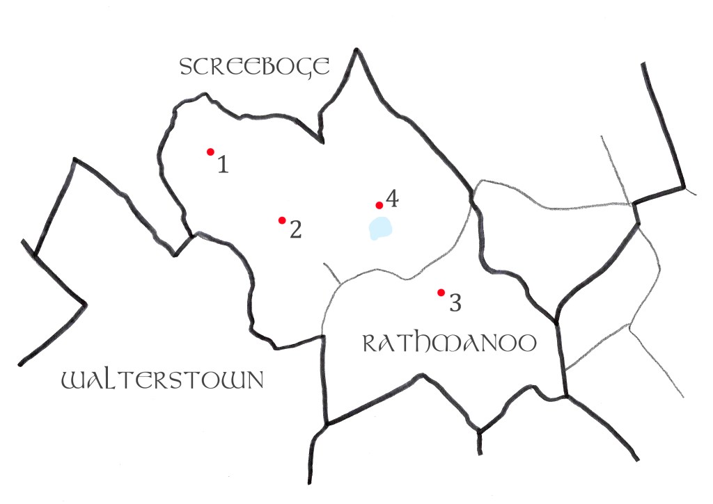
Rathmanoo
1. Ringfort (43 x 17m). D-shaped area located on the summit of a ridge. An earthen bank remains but there’s no sign of a fosse or entranceway.
2. Ringfort (Diameter c. 35m). Raised circular area with earthen bank, external fosse and secondary outer bank.
3. Ringfort (40 x 35m). Platform located on a drumlin ridge with external fosse and outer bank. Ramp entrance and causeway at SSE.
4. Earthwork (Diameter c.30m). Circular enclosure, possibly a Rath, only visible on OS aerial images. Located 80m to the north of a small lake.
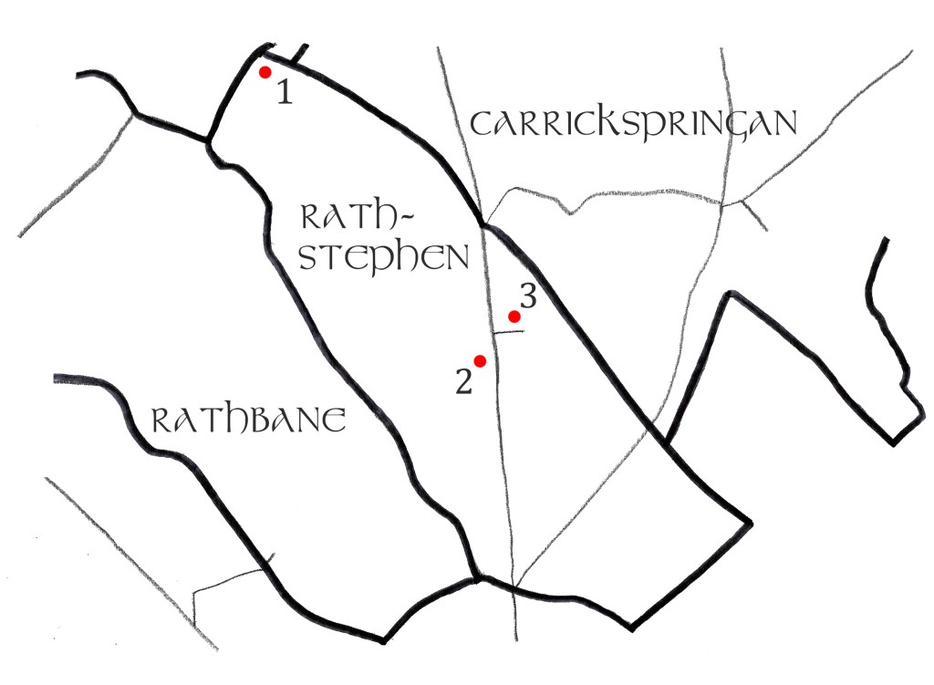
Rathstephen
1. Ringfort (Diameter 56m). Raised circular area with a stone faced earthen bank, rounded external fosse and secondary outer bank. Entrance through inner bank and causeway at SE.
2. Earthwork (Remaining bank: W. 5m, H. 1.7m). Earthen bank locally referred to as a rath. Appears on 1836 and 1938 OS 6″map identified as a ‘mound’.
3. Ringfort (Remaining bank: L. 20m). The monument has been mostly destroyed by quarrying. Only an arc of earthen bank remains running NW-NE.
Shancarnan
1. Ringfort (34 x 31m). Raised circular area with earthen bank, external fosse and secondary outer bank which has a stone facing. Causeway and entrance at both banks through ESE.
2. PondBarrow (Diameter 18m). Circular area with a small impression in the centre. Surrounded by a wide earthen bank but no sign of a fosse or entrance.
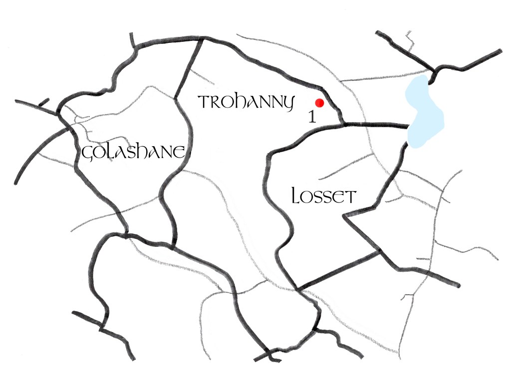
Trohanny
1. Ringfort (27 x 25.3m). Circular area with earthen bank and external fosse. Original entrance at ENE.
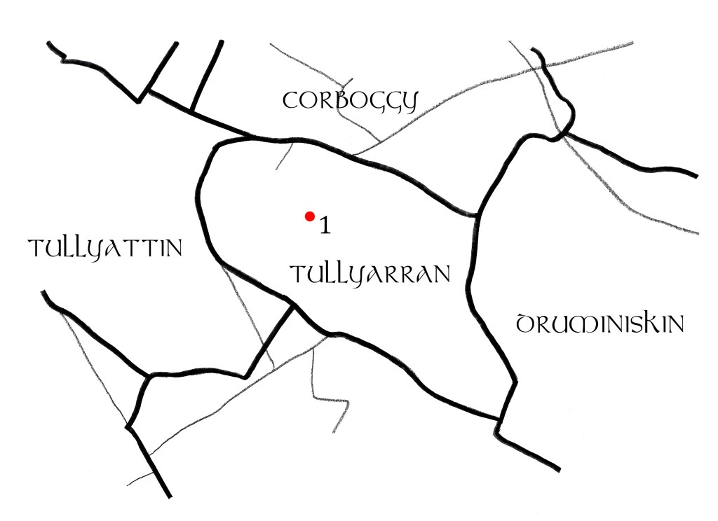
Tullyarran
1. Ringfort (49 x 46m). Situated on the summit of a drumlin ridge. Earthen bank with stone facing and slight external fosse. Described as ‘Tullyarran Fort’ on OS 6″ maps.
Walterstown
1. Souterrain. Appears on the 1908 OS 6″ map where it is identified as a ‘cave’. No visible trace remains.
2. Ringfort (Diameter 39m). Raised platform with only a scarp remaining. There is no visible fosse or entrance.
3. Enclosure (Diameter 80m). Raised semicircular area and remains of a steep scarp within Garryard Wood.
4. Castle (Foundations: L. 13.5 m, W. 8m). Only the foundations survive and are located within Garryard Wood. It was owned by John Betagh in 1640 but was already in ruins at this stage.
* There are no monuments recorded in Hermitage, Ballair, Ballintlieve, Bawn, Cornaville South, Coolnahinch, Fertagh, Glebe, Leitrim Lower, Leitrim Upper, Tullyattin, Tullypole, Ughtyneill, Curraghtown, Drumaneber, Screebog, or Skearke.