The Corleck Head

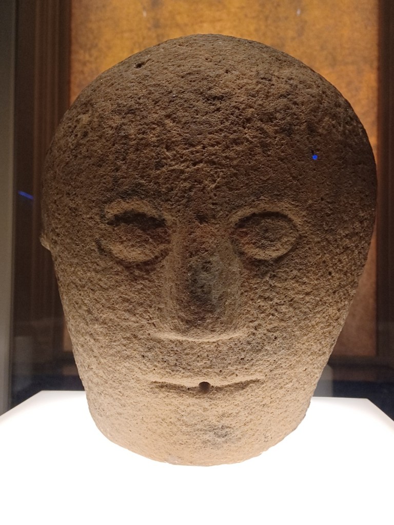
The Corleck Head is a three-faced stone idol found near Corleck Hill, Bailieborough in 1855. It is believed to date to the 1st or 2nd century AD, during the Iron Age, based on it’s similarity to other Celtic artefacts from northern Europe. 

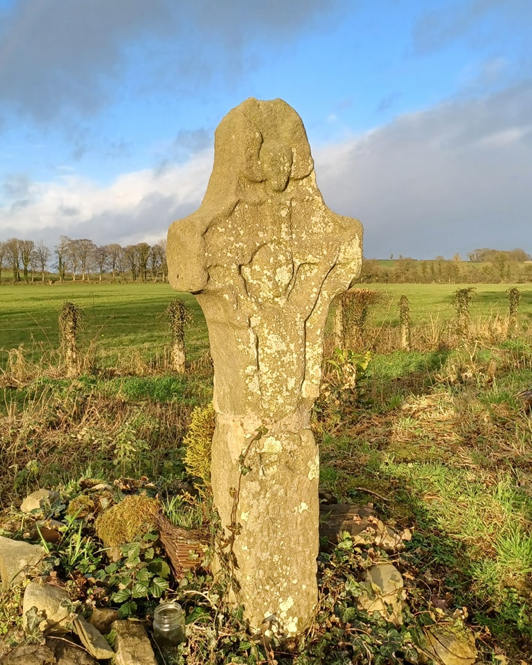
Corleck Hill has been a site of ritual activity since the Neolithic period, as seen by a now lost passage grave dating to around 2500 BC. In the late Iron Age, the hill became an important religious centre and was associated with the Lughnasadh harvest festival. One of the names for the hill in Irish is Sliabh na Trí nDée (Hill of the Three Gods). 

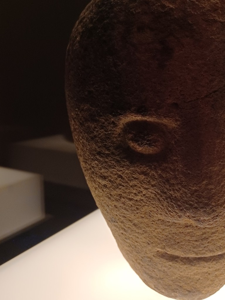
Carved from a single block of limestone, the head features three similar faces with protruding eyes, thin mouths, and unsettling expressions. A hole at its base suggests it may have been mounted on a pedestal or shrine. The three-faced form may represent Crom Dubh, a Celtic harvest god who hoards the yearly grain. A younger god, Lugh, must defeat Crom Dubh to seize the grain for humankind. 

The Corleck Head was likely buried between to protect it from Christians seeking to erase pagan symbols, especially those associated with human sacrifice. 

Sources


Dáithí Ó hÓgáin, The Sacred Isle: Belief and Religion in Pre-Christian Ireland (Woodbridge, 1999), pp. 36-39

Michael J. O’Kelly & Claire O’Kelly, Early Ireland: An Introduction to Irish Prehistory (Cambridge 1989), pp. 290-94

Marion McGarry, Irish Customs and Rituals: How Our Ancestors Celebrated Life (Orphen Press, 2021), pp. 56-62

Seamus MacGabhann, ‘Landmarks of the people: Meath and Cavan places prominent in Lughnasa mythology and folklore’ in Ríocht na Midhe 11 (2000), pp. 219-38 (21 pages)

Morgan Daimler, Pagan Portals – Irish Paganism: Reconstructing Irish Polytheism (Hants, 2015), pp. 52-54 

Bailieborough.com, ‘The Corleck Head,’ Available at http://bailieborough.com/corleck-head/ (May 21, 2025)

100objects.ie (by An Post, The Irish Times, the National Museum of Ireland, and the Royal Irish Academy), ‘Corleck Head,’ Available at https://100objects.ie/corleck-head/ (May 21, 2025)

Nobber motte being burned during an Irish raid.

Nobber Motte

Nobber motte, constructed by Hugh de Lacy in the 12th century, served as the ‘caput’ (head) of the Barony of Morgallion. Over the years, ownership of the motte and the manor of Nobber passed through many hands—from the de Angulos, back to the de Lacys, to the Fitzgeralds, and finally to the Prestons.

In the 15th century, as English control in Ireland shrank to the area around Dublin known as The Pale, Norman settlements on the frontier, like Nobber (though there was an earlier Gaelic settlement here) became vulnerable to attacks by Gaelic Irish armies. In 1425, the McMahons from Oriel burned Nobber and captured 80 Norman prisoners. Not long after, in 1434, the Annals of Ulster records:

“Ua Neill went with a great host a week before the feast of St.Michael this year to destroy the Foreigners of Meath and Ua Domnaill, with his host, was with Ua Neill on that expedition and the host of the whole Province of Ulster was with him……And afterwards the sons of Ua Neill, namely, Henry and Aedh, went to burn the Obair. But, whilst they were burning it, Stanley the deputy of the king came upon them and proceeded to pursue them. Henry and Aedh remained at the rear of their people and brought them off safe with them spiritedly, prosperously that day.”

Due to its strategic position on the Ulster-Meath border, Nobber was reinforced in 1573 with 40 horsemen and carbines under the Earl of Kildare’s command. The motte is also recorded as being in use as late as 1648, during the Confederate War (when both Gaelic and Norman alike rebelled against the Crown), where it was used as a fort by the Parliamentarian Army.

In the illustration, the motte and its palisade wall are depicted as a square, though they were actually circular. This is the best I could do using AI and Photoshop, unfortunately, but I think the image still conveys how imposing the fort would have been in its heyday. Nobber motte stands almost 8 meters tall, has traces of an adjoining bailey (a courtyard with barracks and outbuildings), and controlled a crucial crossing point over the River Dee.

Sources


National Monuments Service, Monument ME005-070, Available at https://maps.archaeology.ie/HistoricEnvironment/ (Aug. 23, 2025)

Daniel Brown, Hugh de Lacy, First Earl of Ulster: Rising and Falling in Angevin Ireland (Woodbridge, 2016), p. 249

Charles Mount, ‘Notes on the history of the manor of Nobber’ in Riocht na Midhe, Volume 19 (2008), pp. 79-84

The Annals of Ulster, U1434.3, Available at https://celt.ucc.ie (Aug. 23, 2025)

Noel French, Nobber-A Step Back in Time (Trim, 1991), Available at https://meathhistoryhub.ie/nobber-a-step-back-in-time/ (Aug. 23, 2025)

The gate at Robertstown graveyard

Robertstown Cemetery

St. Brigid’s Church in Robertstown once formed part of the vast Barnwall estate. The Barnwalls, along with the Plunketts of nearby Ardamagh Castle (Castlecam), were two of the major landholders in North Meath before the arrival of Cromwell.

The church was likely built around the same time as Robertstown Castle, which became the residence of the Barnwall family from the late 16th century onwards. However, the Barnwalls had lived locally for centuries before that. Records indicate that the manor was burned during a Gaelic Irish raid as early as 1311. At the time, the manor would have been centred on the Motte in the neighbouring field.

Two notable graveslabs can be found on the church site: one dedicated to Alexander Barnewall & Alison Nettervil (1618), with the Gaelic inscription ‘GAN GAN EAGLE’,* and a second to Francis & Catherine Plunkett (1688). Both have since fallen into the crypt.

Aside from the grave slabs, the only other significant feature is a stone cross with an inscription dating to 1685, found in the laneway leading into the graveyard. The inscription reads: ‘SOVERAIN LORD KING JAMES THE SECOND BY THE GRACE OF GOD’.

This refers to James II, King of England, Ireland, and Scotland, who was deposed by William of Orange during the ‘Glorious Revolution’ of 1688. He fled to France, and then to Ireland to raise an army, promising religious tolerance to both Catholics and Protestants. James, however, was defeated at the Battle of the Boyne, leading to many Hiberno-Norman families like the Barnwalls and Plunketts having their land forfeited.

Legend has it that a Cromwellian settler named ‘Gutters/Gooders’ once took possession of Robertstown Castle, and gained notoriety for shooting at passersby on their way to Mass from the castle window. Gutters was finally shot by a priest and is said to be buried in Mullaghvally. Locals would thrown a stone over his grave every time they passed to prevent him from rising.

* ‘GAN GAN EAGLE’ is potentially an old Irish spelling of ‘Gan eagla’ (Without fear).

Sources


National Monuments Service, Monument ME011-005002, Available at https://maps.archaeology.ie/HistoricEnvironment/ (July. 19, 2025)

National Monuments Service, Monument ME011-006, Available at https://maps.archaeology.ie/HistoricEnvironment/ (July. 19, 2025)

Abraham Kennedy, ‘Upward Mobility in Later Medieval Meath’ in History Ireland Magazine, Features, Issue 4 (Winter 1997), Medieval History (pre-1500), Medieval Social Perspectives, Vol. 5

B.J. Graham, ‘Anglo-Norman Settlement in County Meath’ in Proceedings of the Royal Irish Academy: Archaeology, Culture, History, Literature Vol. 75 (1975), pp. 223-249

Robert C. Simington (ed.), The Civil Survey, A.D. 1654-1656. Vol. 5: County of Meath, with the returns of tithes for the Meath baronies. Irish Manuscripts Commission, Dublin Stationary Office (1940), p. 357

Jack Fitzsimons, The Parish of Kilbeg (Kells, 1974), p. 263

Dúchas, National Folklore Collection, ‘The Schools’ Collection’, Volume 0705, Page 329